|
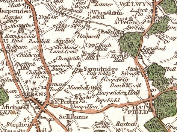
John Cary's 1787 Map of Hertfordshire |

click on map for larger image on Wikimedia Common
Cary's 1787 Map of Hertfordshire
The map is number 49) in D. Hodson's The Printed Maps of Hertfordshire 1577-1900. It was published with the map of Herefordshire on the back.
The above detail shows the parish of Sandridge