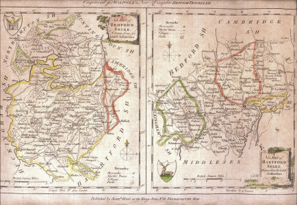
Engraved for WALPOOLE's New & Complete BRITISH TRAVELLER
 |
 |
 |
Published by Alexr Hogg at the Kings Arms No 16 Paternoster Row
|
The new British traveller; or, a complete modern universal display of Great-Britain and Ireland ... And including a valuable collection of landscapes, views, county-maps, &c .... The whole published under the immediate inspection of George Augustus Walpoole, Esq. assisted ... by David Wynne Evans, F.R.S .... Alexander Burnet, L.L.D .... Robert Conway, A.M. and others London, Alexander Hogg, 1784. |
The Hertfordshire Map is No 48 in Printed Maps of Hertfordshire
A later version states the map was engraved by T. Conder.
It should be noted that this is one of the last maps to be produced before reasonable accurate surveys became widely available.
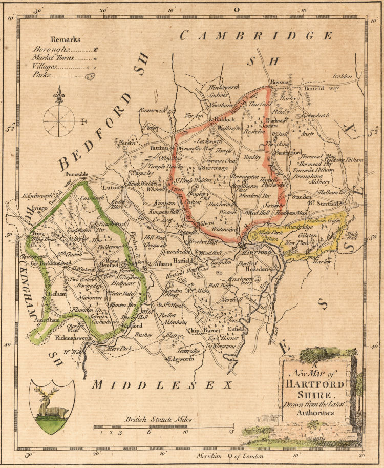
A New Map of Hartfordshire Drawn from the Latest Authorities
|
|
|
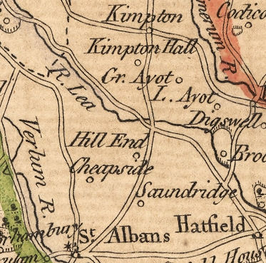
The selection of place names seem to be very idiosyncratic, Cheapside and Hill End are both individual farms in the parish of Sandridge but the significant villages of Wheathampstead and Harpenden are not shown.
[The colouring of this copy of the maps should be ignored.] |
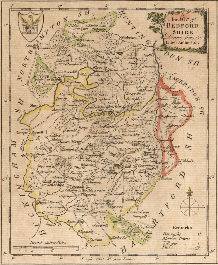
A New Map of Bedfordshire Drawn from the Latest Authorities
 |
The plate also appeared in The new and complete English Traveller: or a new historical survey and modern description of England and Wales ... Written and compiled from the best authorities, by a society of gentlemen ... Revised, corrected and improved, by William Hugh Dalton, Esq ... with ... correct maps ... London, Alexander Hogg, [1794]
This version omits the inscription at the top of the plate and at the bottom right has been added the words T. Conder Sculpt. The map area is 5.8" by 7.2".
Click on image for large Wikimedia image |