Ordnance Survey maps were originally drawn up by military surveyors, in the first half of the 19th century, to cover the whole country with a uniform mapping and there is no intention of attempting to describe the history, or the very wide range of generalist and specialist maps that have been produced over the last two centuries, except to say that the modern mapping is fully digitised, and that virtually all modern road and street maps are derived from the data, and most old maps are covered by the Old Maps site. I will concentrate on the maps which are readily accessible and useful to the family historian.
First Edition 1 inch maps: These have been reprinted and are at a scale of 1 inch to the mile. The original survey was engraved on copper plates and major changes - such as the building of railways - were added later. Rural areas are usually much as the original survey. The scale is too small to show individual fields or smaller buildings. The latest reprints, which have transferred the map to modern grid lines at 1:50,000 for direct comparison with modern O.S. maps, are available from www.cassinimaps.com and are highly recommended.
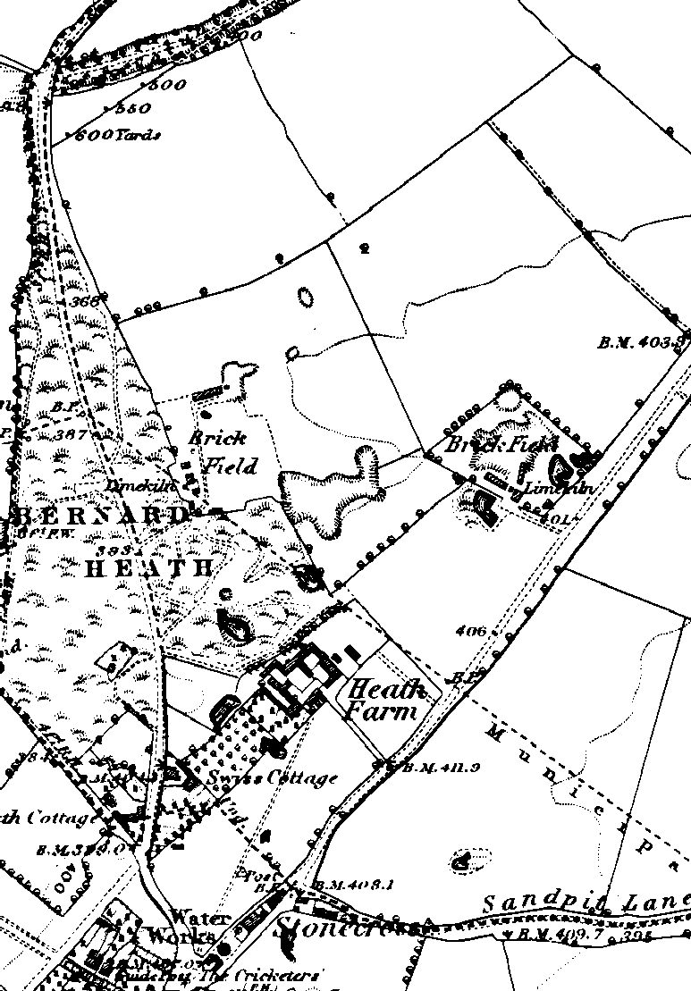
The above shows the kind of detail available on the 1880 maps
(from A
Short History of Bernards Heath)
Large scale maps from circa 1880: The 6 inch to the mile maps have been digitised and are available online from the free site British History Online or old-maps - who will sell you a map centred on the area of interest to you. This shows individual woods and fields and even buildings, and for a larger farm it should be possible to identify a number of buildings. It should be noted that for most rural districts there would have been very little change over the preceding centuries, except where open fields had been enclosed.
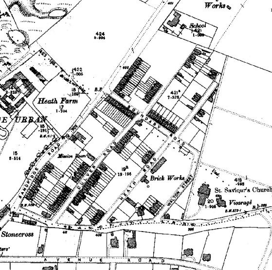
The above shows the kind of detail available
on the 1900 reprints
(from A
Short History of Bernards Heath)
|
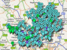
Old Ordnance Survey maps from circa 1900: For most of the towns of Hertfordshire large scale maps, which clearly show the layout of individual properties have been reproduced by Alan Godfrey Maps and are available cheaply. Typically additional information is printed on the back - such as the contents of contemporary trade directories. Explorer series of modern walking maps: These are effectively the standard walking maps of the area - and show individual fields, footpaths and buildings in rural areas. Essential if visiting the rural area where your ancestors come from. Less satisfactory than a street map for urban areas. County and Town Street Atlases: Modern maps - from motoring atlases covering the whole country, via street atlases for individual counties, down to street maps of individual towns, are widely available. A modern street atlas for Hertfordshire is very useful. In the countryside fine details such as fields, are not shown (although woods usually are) and clusters of buildings are shown symbolically - and sometimes named. Unfortunately the index only includes the main district areas and road, and individual farms, etc, are often named on the map, but not indexed. Multimap provides an online version. HALS has a large collection of maps, including large scale O.S. maps, while larger town libraries such as those at Hemel Hempstead, St Albans and Watford, have good collections of large scale O.S. Maps. |
The Godfrey Edition |
||
| Baldock | 1921 | ||
| Berkhamsted | 1897 | ||
| Boxmoor | 1897 | ||
| North Chilterns (1 inch) | 1888 | ||
| Chorleywood | 1896 | ||
| East Barnet & Southgate | 1897 | ||
| Harpenden | 1897 | ||
| Hatfield | 1896 | ||
| Hemel Hempstead | 1897 | ||
| Hemel Hempstead (South) | 1897 | ||
| Hertford (North, South) | 1897 | ||
| Hertfordshire (North) (1 inch) | 1888 | ||
| Hitchin | 1898 | ||
| Hoddesdon | 1896 | ||
| Rickmansworth & Croxley Green | 1896 | ||
| St Albans (NE, NW, SE, SW) | 1897 | ||
| Tring | 1897 | ||
| Ware | 1896 | ||
| Watford | 1896 | ||
| South Watford & New Bushey | 1896 | ||