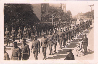
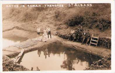
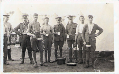
|
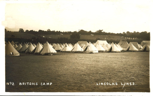
Britons Camp
St Albans, World War One
|
|
|
|
In August 1914 the 2nd London Division moved
to their war station in the St Albans area (see
The London Gunners come to Town),
and army camps were set up over a large area of West Hertfordshire. These
continued through much of the First World War, and one of these camps was known
as Britons Camp, which appears to have existed in the Summer of 1915 |
|
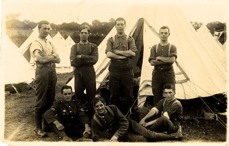 |
 |
|
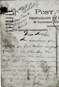
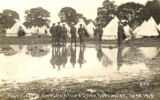
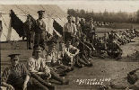
Postcard sent by John (?02614 2/2nd ???
RAMC, Britons Camp, St Albans, Herts) on 15th August 1915 to Mrs W H
Payne, Heathfield, Ramsden, Billericay, Essex
Dear Mother. I'm sending you a photo we had taken in front of
our tent the other day. The other chaps are the others in our tent. Sid
has gone into another tent now with the other officer servants and we have
a lance corporal instead. Will write a letter in a dy or two. With love to
all from John.
Photographer L L Christmas, 23 Catherine Street, St
Albans |
A group of six postcards said to be
of the 2/4 Leicesters
|
|
Other Pictures |
 |
|
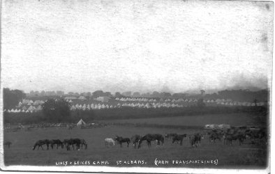
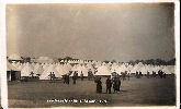
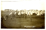
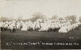
Lincs
and Leices Camp, St Albans, 1915
photographed by L. L. Christmas, of St Albans
Undoubtedly the same camp, and length
of shadows suggest summer, but no location clues.
[Thumb from card advertised on ebay,
2010] |
|
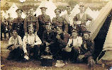
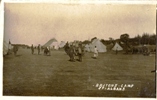
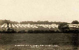
Lincolnshire Regiment, Britons Camp, August
1915
No title or photographer. Not posted
Message: With Best Love / Harry / Britons
Camp / Aug 1915
Hedges show compatible location
but nothing identifiable
[Thumb from card advertised on ebay,
2010] |
|
 |
|
See also
First World War pages
While Briton's Camp was somewhere near St
Albans it exact location is, at the time of writing, unknown.
Mike Neighbour kindly suggested it might be the area between
Sandridge Road and Beech Bottom. He pointed out that a firm
called Hammonds had built the houses in this area on what was
called the "Briton Estate" in 1938 - and there is a pub called
the Ancient Briton, which was built at about the same time
(first listed in 1937 Kelly's Directory for Hertfordshire). I
know this area very well (see
A Short History
of Bernards Heath) and it is very likely that troops
made use of the area during the First World War. However a
careful look at the picture and a comparison with old maps
suggests it was somewhere else - so another job for the
Postcard Detective.
|
Can you help

The Postcard Detective |
|
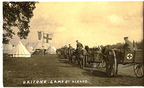
So where was Britons
Camp? |
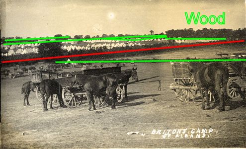
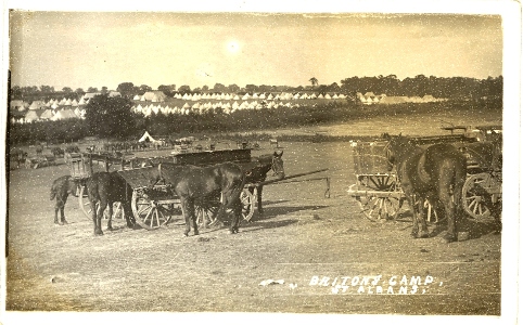
Evidence for the Location of Briton's
Camp
-
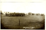
There is only one photograph which shows enough of the
area where the camp is to be of any use in identifying the location
-
This photograph shows no building or any distinctive
single feature which would be sufficient to identify the area.
-
A straight road cuts across the picture from left to
right.
-
On the near side of the road there are two fields, one
containing the horses and the other empty, separated by a straight hedge
meeting the road at right angles.
-
On the far side of the road there is a large field
containing the tented part of the camp.
-
At the top right of the camp field there are a
significant number of large trees - which must be part of a wood.
-
Beyond the camp field there are indications of two
further fields.- but no clues as to their shapes.
-
The photograph is looking down a comparatively gentle
slope, and can see the tented part of the camp over a hedge which would hide
it if the ground was level.
-
Allowing for the trees the horizon is level - suggesting
the absence of and significant gradients.
-
The trees are in leaf - ruling out the possibility that
the picture was taken in the winter.
-
The absence of single or groups of trees in the fields
suggest that it not part of the park of a large house.
-
The sub is shining and the shadows of two of the horses
can be clearly seen, and the length of the shadow suggests that the sun is
about 50o above the horizon. This suggests the picture was taken
towards the middle of a Summer day and the road is running towards the
North.
If we put all these observations there is a
lot of evidence to say where the camp was not. We need three field separated
with a straight length of road running somewhere between NW and
NE with a wood to the North. In addition the general conformation of
the ground would appear to rule out the valleys of the Ver and the Lea.
In theory it might be possible to look at a
large scale map of the area round St Albans made at anout this time - the O.S.
1:2500 maps made at the very end of the 19th century might do, and eliminate
fields one by one - and see how many candidate sites are left, However if anyone
knows the location of any temporary army camp near St Albans I would be grateful
is they could tell me.
February 2010
Extract from the
Leicestershire Regiment page of
The Long Long Trail.
2/4th Battalion
Formed at Leicester in September 1914 as a second line unit.
Became part of 2nd Lincoln and Leicester Brigade, 2nd North
Midland Division. Moved in January 1915 to Luton and by July
1915 was at St Albans. August 1915 : formation became the
177th Brigade, 59th (2nd North Midland) Division.
April 1916: moved to Ireland.
January 1917 : returned to England and moved to Fovant.
24 February 1917 : landed in France.
8 May 1918 : reduced to cadre strength and returned to
England with 16th Division.
20 June 1918 : absorbed by 14th Bn |
~~~~~~~~~~~~~~~~~~~~~~
Suggestion received: Britons
Camp could be, Bridons Camp located one mile from Water End on Red Lion
Lane nr Hemel Hempsted .
Thanks for an interesting suggestion which
I had not considered, with the soldiers giving their camp a name similar to
an existing place name.
I have now looked at modern satellite photographs and the 1880s Ordnance
survey and compared them with the photograph. Clearly Britons Camp would
not have been on Bridens Camp (which is in a wood) but looking at the maps
there was a possible similarity with the location of road, field boundaries
and woods involving Red Lion Lane and Birchley Wood. However a closer look
show that some groups of trees which were there in 1880 were still there
over 100 years later - but are not in the photograph. In addition the camp
was on comparatively level land - while the Red Lion Lane area is on the
side of the Gade Valley and the lie of the land is wrong.
July 2010
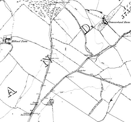 John
Vaughn sent a photograph of some fields and the north running road in shown in
this large scale map of 1884 of the area imediately north of Sandridge Village.
I am sure the picture is not taken from the same position and, for instance,
there is no sign of the wood. However it does highlight a possible area.
At the top of the map is part of No Mans Land
Common and at least part of the boundary is now heavily wooded and a hedgerow
with trees is shown in 1884. The is also a shallow valley running across the
area, the higher ground being to the north-west and the south east. With one
exception all the hedgerows in the triangular area between the roads in the
centre of the map have now been removed. At the moment the triangular field is
under crops but once they have been harvested it would be well worth a visit to
see if one can find a spot in the area where the slopes match the picture with a
possible site for the wood. However the more look at the contours and some
of the bench marks (not really visible in the reproduction here) the more
I have my doubts.
So if any of you can either confirm this site
- or come up with another suggestion I would be grateful.
B.T.W. A significant part of the area is now
part of Heartwood Forest
while part of the land to the right of the map was farmed, for over 100 years,
by my ancestors.
 |
|
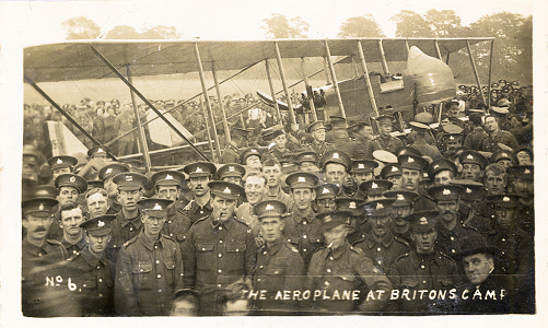
A
Maurice Farman MF-11 Shorthorn plane at Briton's Camp, St
Albans in the summer of 1915 |
 |
|
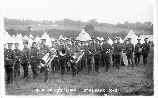
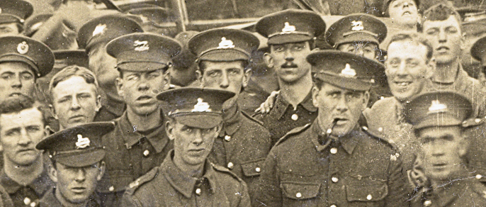
The back of the card gives no clue to its origin
(and there could have been more than one "Britons Camp" during the
war. However most of the cap badges show the sphinx of the
Lincolnshire Regiment, or the tiger of the Leicestershire Regiment -
confirming the date and location as summer 1915 at somewhere near St
Albans. |
The Picture of the
A Maurice
Farman MF-11 Shorthornplane
at Briton's Camp, St Albans. suggests another possibility. There was definitely
an aerodrome at London Colney in the early part of 1916, immediately south of
the
If you can add to the information given
above tell me.
|
May 2006 |
|
Page created
|
|
December 2009 |
|
The Postcard detective called in
|
|
January 2010 |
|
Thumb of L Christmas
post card |
|
February 2010 |
|
Extract about Regiment; Bridens Camp suggestion |
|
July 2010 |
|
Area north of Sandridge |
|
July 2010 |
|
Ebay card thumb added |
|
July 2015 |
|
Aeroplane postcard |
|
November 2016 |
|
Lincs PC from Chris |




 John
Vaughn sent a photograph of some fields and the north running road in shown in
this large scale map of 1884 of the area imediately north of Sandridge Village.
I am sure the picture is not taken from the same position and, for instance,
there is no sign of the wood. However it does highlight a possible area.

