|
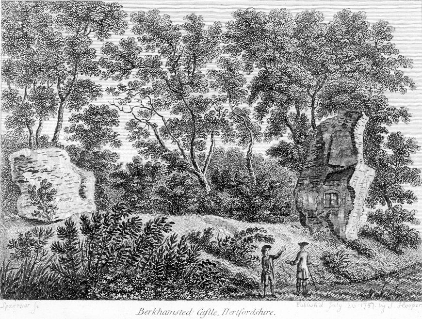
Berkhamsted Castle |


|
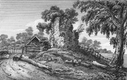
From Antiquities of England and Wales by Francis Grose
Berkhamsted Castle, Hertfordshire Sparrow fc. [fecit]; published July 1787 by J. Hooper |
 |
|
Berkhamsted Castle |
|
From Antiquities of England and Wales by Francis Grose
Berkhamsted Castle, Hertfordshire Sparrow fc. [fecit]; published July 1787 by J. Hooper |
|
|
|
From Remains of Berkhampstead Castle Herts Engraved by W. Wallis from a Drawing by F. W. L. Stockdale for the Antiquarian Ity. Published for the Proprietors Feb. 1. 1818 by W. Clarke, New Bond St. |
|
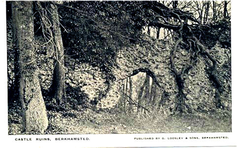
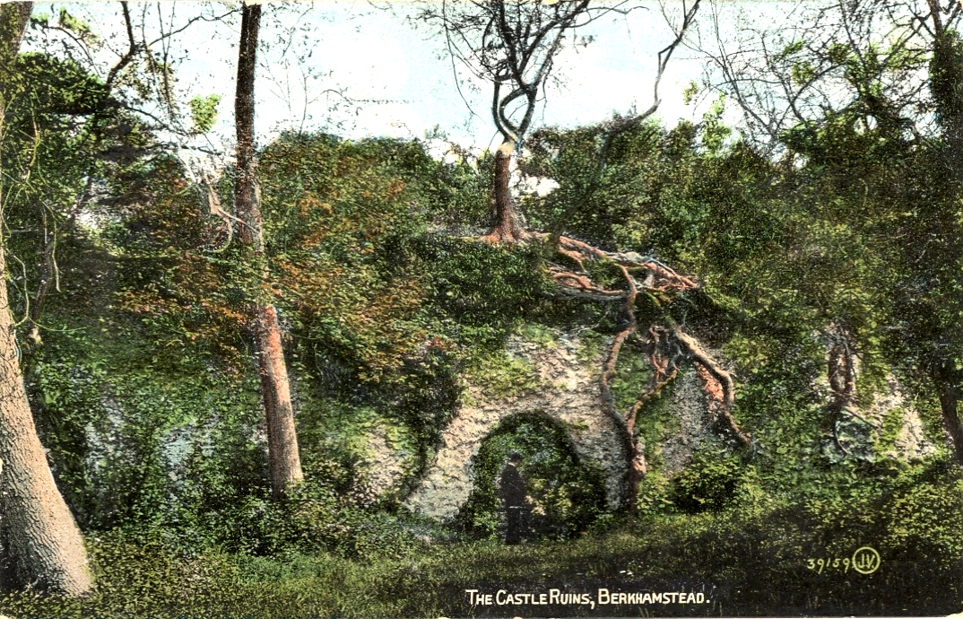
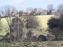
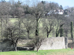
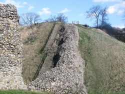
BERKHAMPSTEAD CASTLE (Mount and Bailey), N. of the town, in the bottom of a wide, shallow combe, running S. to the river Bulbourne, stands about 340 ft. above O.D. The earthworks form one of the finest examples of a Norman military fortress, and present the unusual feature of a series of concentric defences and outworks, which are exceptionally well preserved. The castle was besieged and taken by Louis of France in 1216. The Keep Mount is a large truncated mount, 40 ft. high above its ditch, and carries the foundations of a circular shell�keep, 60 it. in external diameter, with walls of flint rubble, 8 ft. thick. On the S.W. a small fore-building connects the keep with two wing walls, which formerly descended the mount and joined the curtain wall; only a few feet remain of the S. wall. The other is 12 ft. thick, and has been breached near its lower end in filling up the ditch between the mount and bailey. Inside the keep is a well, lined with 12th-century masonry, and the remains of a fireplace, probably of the 15th century, with stone curbs and arch, and backed with herring-bone tiles. The Bailey, which covers about 21 acres, and lies S.W. of the mount, stands 6 ft. above its ditch, and is partly surrounded by a light bank and a 12th-century curtain wall of flint rubble, about 7 ft. thick. The foundations of two hollow, semicircular flanking towers remain on the E. side, 30 ft. wide. A gap in the S. wall indicates the position of a gateway (9 ft. wide), which has two flanking towers projecting 8 ft. outwards towards the ditch, and 20 ft. inwards. Opposite these, and in a line with them, on the middle bank, are two pieces of flint rubble wall, 14 ft. apart, forming a portion of the original approach from the town. A few fragments of wall continue the line of the curtain round the S.W. corner towards a large and nearly rectangular Tower, about 40 ft. by 50 ft., in the middle of the W. side. This tower stands across the curtain wall, and is contemporary with it. Only the basement and the N.W. angle of the upper part remain. A short flight of steps on the N. side formerly led from the bailey to the first floor. The angles of the tower project as pilasters except on the E. A 12th-century jamb and two steps in the S.W. angle indicate the approach to a staircase. Outside the curtain, a later building', probably of the 13th century, has been added on the W. and N.W., but only three cellars, built of flint rubble, remain, with connecting doors and a corner hearth. Heraldic and other ornamental floor tiles have been found here. N. of this building are two walls, making, with the re. entrant angle, another and later addition, probably of the 14th century. The curtain wall, much overthrown, continues N. to the N.W. angle, where it has been strengthened outside, at Its base, by a solid segmental projection of flint rubble, possibly the base of a flanking breastwork. A little to the S.W. lies a rectangular tongue of masonry, with chalk filling (18 ft. by 16 ft.), of about the 14th century; it projects towards the ditch without joining the curtain, and was possibly the approach to a bridge. The curtain wall on the N. has been removed completely except at the N.E. angle, where there are remains of a postern gate passage leading N.; near it are the foundations of some rectangular chambers. A short piece of a cross wall remains, apparently dividing the bailey into two unequal wards, and abutting against the E. curtain, near its N. end. The foundations of a tower (about 18 ft. square), exist at the junction, and there are indications of a range of buildings on the S. of the cross wall. Outworks: a wet ditch surrounds the inner bailey and broadens out on the S.E. and the W. to form pools, the latter being of considerable extent. Beyond this is a bank 10 it. to 17 ft. high, carrying a modern path. At the S.E. and S.W. corners are mounts or cavaliers, 7 ft. to 9 ft. higher, and there is a similar mount opposite the postern gate on the N. A middle ditch follows the line of this bank except on the S., where it has been encroached upon by the London and North-Western Railway, and a modern road. An outer bank, 10 ft. to 22 ft. high, covers the N. and part of the E. sides, and against its outer slope, and level with its crest, are placed eight large platforms, about 55 it. to 65 ft. long. Five are on the N. and three on the E. These are possibly siege platforms of the 13th century. There is a slight and ill-defined outer ditch communicating at the N.E. angle with the middle ditch through a gap in the outer bank, and again beyond the westernmost platform. Entrances: the gate on the S. leading direct to the town in line with Castle Street; the postern (or Derne-gate) on the N.; the "great gate" on the W. is alluded to in several surveys, but the position is indeterminate. This gate was covered by a large ravelin or barbican, now partly obliterated by a modern road, and the S. portion forms a watercress bed. The present entrance is by a modern cut through the middle bank. Dimensions - Greatest length from outer ditch on N.E. to road on S. W. 900 ft. Greatest width :from modern road on W. to outer ditch on E., 800 ft. Length of bailey, N. to S., 450 ft.; width, W. to E., 310 ft. Diameter of keep mount at base, N. to S., 220 ft.; W. to E., 180 ft. Width of middle ditch, 60 ft. to 70 ft. Area within the crest of middle bank, about 8� acres. Total area defended, about 15� acres. Condition - Earthworks, very good; masonry, bad, overgrown with ivy, requires prompt attention.
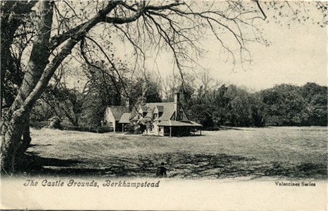
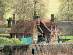
Entrance to Castle Grounds, Berkhamsted. E. Needham & Co, Alexandra Series A08741
|
� Text and Map from |
|||||||||
|
Book: Berkhamsted Castle 1066 to 1495 A history of the Castle, together with a report on the remains as they are at the end of the 20th century. |
||||||||||
|
Web Sites: Berkhamsted Castle (Local History Society) |
||||||||||
|
|
||||||||||
|
|
||||||||||
|
|
||||||||||
|
|
||||||||||
|
|
||||||||||
|
||||||||||