|
|
 |
 |
 |
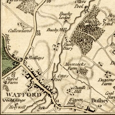
from Cary's Actual Survey of the Country Fifteen Miles Round London
In 1800 Watford was a market town, surrounded by farm land and estates, lying across a ridge between the Colne and Gade Rivers. Like many other towns and villages in Hertfordshire it was strung out along a road radiating from London, in this case going to Aylesbury and beyond. (For a contemporary strip map of this road see Bowles' Post Chaise Companion.) Briton's The Beauties of England & Wales: Hertfordshire, written in 1807, provides a very detailed description of the church and its memorials - but only the following short description of the town itself:
Watford is a large, populous, and busy town; the houses are principally of brick; many of them are respectable and handsome buildings; they principally range on the sides of the high road, and extend in a north-westerly direction rather more than a mile. The chief employment of the laboring classes is derived from agriculture; but additional labor is furnished by the throwing of Silk, three Silk Mills having been established in and near the town. The largest Mill is worked by the waters of the Colne river; but the others are worked by horses. The population of Watford, as ascertained under the late Act, was 3530; the number of houses was 691.
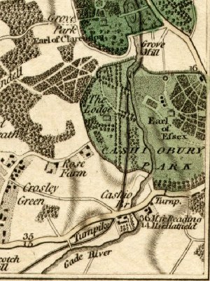
The above map shows the newly built Grand Junction Canal running through Cashiobury Park. The railway, which was the driver for the major expansion of Watford in Victorian times, was not built until 1837.
Page created August 2007