|
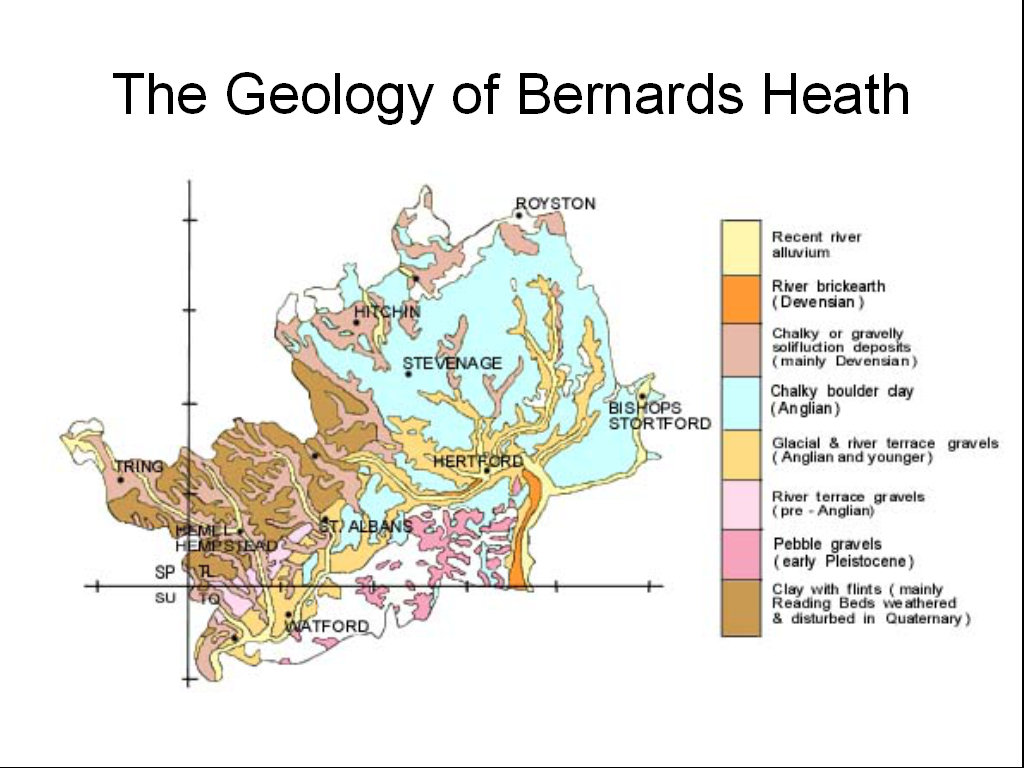
It is important to
understand the geology beneath Bernards Heath. Much of the
high ground of the Chilterns is covered with "clay with
flints" (brown in this map). This lies on top of several
hundred feet of chalk. The chalk allows water to pass, and
the water table is sometimes nearly 200 feet down.
The above map come from
Hertfordshire Geological Society web site and it
describes the above map as follows:
Compared with the solid formations,
the superficial or Quaternary deposits of Hertfordshire
(Fig. 3) are
much more variable in nature and are often laterally
impersistent. They originated in various ways, the four
most extensive types being:
 |
Gravel
deposits of the River Thames, dating from a
period when it flowed north-eastwards
through
the Vale of St. Albans rather than following its
present course through London. |
|
|
Clays and
gravels deposited by a glacier, which entered NE
Hertfordshire about 400,000
years
ago (the Anglian Stage) and blocked the earlier
course of the Thames, thus
causing
the southward diversion through London. |
|
|
Sediments
deposited by the wind under very cold dry
conditions or sludged down slopes
such
as valley sides when the surface layer of a
frozen soil melted in summer sunshine. |
|
|
The
Clay-with-flints, which forms a thin layer (<15
ft) over the Upper Chalk on The Chiltern Hills. |
|