|
|
Cheshunt's Past in Pictures by Peter Rooke The Rockingham Press, 1994 |
 |
||
|
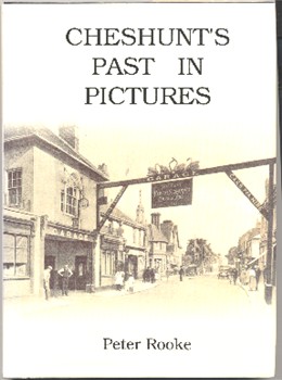
This is an well produced book of photographs, many from around 1900, with a brief text on each picture. The cover shows the Four Swans Inn, with its sign bridging the road, from before the First World War. The Introduction explains that this book covers the ancient parish and former Urban District of Cheshunt, which includes Waltham Cross, Goffs Oak and Turnford. Until well into the 20th century this scattered district consisted of little more than a ribbon of development along the Old North Road from the Middlesex boundary to the south to Wormley in the north, with isolated settlements around the parish church at Churchgate, at Flamstead End, and at Hammond Street and Goffs Oak on higher ground to the west.
|
CONTENTS Introduction (includes detailed 1807 map of the district) Around the District (Waltham Cross, Theobalds, Crossbrook Street, Turner Hill, Cheshunt High Street, Turnford, College Road, Church Lane, Churchgate, Flamstead End.) The Big House Churches Education Transport Leisure Work Events Shops Pubs Cheshunt People Index |
|||

