
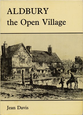
 ALDBURY
The Open Village
A portrait of country life
The Author, 1987
A5 paperback, 176 pages with illustrations and maps
This is an excellent book which looks in depth at the changes that occurred in the village in the early 19th century, at the time that the Earl of Bridgewater came to Ashridge house. There are plenty of photographs and some excellent redrawn maps, based on contemporary maps. There are also useful details of the sources used and the book could be of great interest to anyone interested in village life in Hertfordshire 200 years ago.
The only "complaint", from the point of view of the genealogist, is that while it includes a large number of references to named individuals, there is frustratingly no name index.
To give a flavour of the book I reproduce the Introduction below:
INTRODUCTION
This is an account of how life has altered for the inhabitants of Aldbury from mediaeval times to the present century, for the farmer, the labourer, the parson, the victualler, the Lord of the Manor, the craftsman and the tradesman. It tells also of the physical changes in the heart of the village and in the fields, woods and commons, to explain how Aldbury has become the place it is today.In particular the book focuses on the early years of the nineteenth century - a period of great social, economic and structural change set against a rare background of agricultural survival and near stagnation. Personal records of the time add a unique lustre to the solid basis of documents and volumes which endure for so many parishes - the registers, the accounts of the overseers and the churchwardens, the Vestry minutes, rate books and so on.
The first half of the nineteenth century was dominated not only by the Napoleonic wars and their aftermath but by a rising population. Both led inevitably to increases in unemployment, poverty and social disturbance; and the resulting reformation of the Poor Law affected every parish. Other special and local influences were felt in Aldbury.It has never been enclosed by Act of Parliament and only to a minor extent
by private agreement until the present century, a fact which has bestowed upon it both peculiar advantages and historical rarity. The development of the agriculture and the history of those who lived by it, together with the evolution of the landscape, are therefore explored thoroughly and compared locally. What emerges is a portrait of a rural community seen in the round, through many pairs of eyes, in which the relationships of families, the roles played by identifiable individuals and the interplay of social and religious groups can be observed.Importantly, the central period both begins and ends with a detailed map of the parish, accompanied by a list of owners and occupiers, fields and furlongs, areas and values. Comparison of the two maps underlines the physical changes which did, or did not, take place in both the agrarian and the human environment.
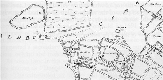
Redrawn section of 1803 Map
For more information ser The Aldbury Holloways
David Jenks, newly appointed as Rector by Lord Bridgewater in 1803, kept a diary from the day of his arrival until shortly before his death fifteen years later. Yet another contrasting journal, accompanied by personal correspondence, charts the erratic progress of a village courtship. And at least five artists left their impressions of the village at that time, including the celebrated Lincolnshire painter, Peter De Wint.
Upon the stage which Aldbury provides, it is inevitable that most of the players will be extras, unable even to sign their names; only a handful will take the leading roles.And so the main story begins in the early summer of 1802, when a number of influential villagers were gathered together in the Vestry of the church of St John the Baptist, to consider the idea of making a map.
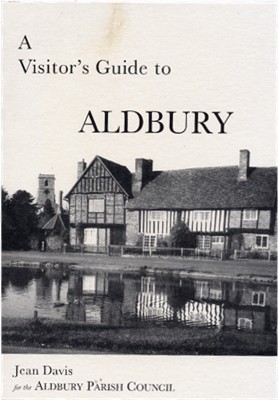 A
Visitor's Guide to Aldbury
A
Visitor's Guide to Aldbury
ALDBURY
Aldbury Parish Council, 1980
A5 booklet, 16 pages with line drawings and map
This is an ideal guide for someone visiting the village and who wants to spend a few hours looking at the many old buildings, and learn a little about each. There is a two page historical introduction, a village map with 37 locations identified and briefly described. Two pages cover "Further afield" and the surrounding countryside, and a page discusses local folklore.
| Locating
Books At the time this page was last updated second hand copies could be ordered online. New copies of the Visitor's Guide are available for sale in the village shop. |
Page created September 2006