|
|
|
||
|
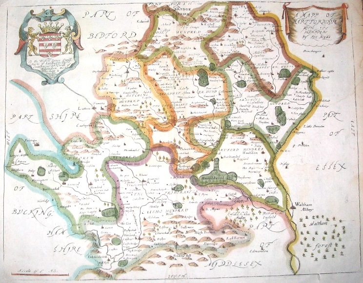
A Mapp of Hartfordshire Richard Blome 1673 |
|
|
|
||
|
A Mapp of Hartfordshire Richard Blome 1673 |
 |
Published in
Britannia: or a geographical description of the kingdoms of England, Scotland, and Ireland ... illustrated with a map of each county of England, besides several general ones ...
London, Richard Blome, 1673
The map is based on the earlier map by John Speed, first published in about 1610.
There are enlarged images of the various hundreds
The map does not show the detached parishes of Cashio and Dacorum