 |
|
||
|
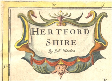
Robert Morden Published in Camden's Britania |
|
|
||
|
Robert Morden Published in Camden's Britania |
Various editions 1695-1772
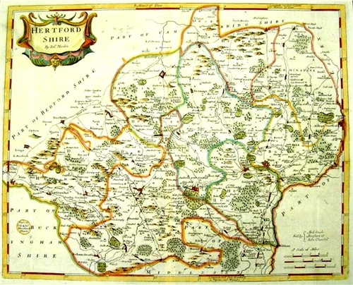
1753 edition
The Maps are all new engrav'd, either according to Surveys never before publish'd, or according to such as have been made and printed since Saxton and Speed. Where actual Surveys could be had, they were purchas'd at any rate; and for the rest, one of the best Copies extant was sent to some of the most knowing Gentlemen in each County, with a request to supply the defects, rectifie the positions, and correct the false spellings. ... this whole business was commited to Mr Robert Morden ... who took care to revise them, to see the slips of the Engraver mended, and the corrections, return'd out of the several Counties, duly inserted. Upon the whole, we need not scruple to affirm, that they are by much the fairest and most correct of any that have yet appear'd. And as for an error here and there; whoever considers, how difficult it is to hit the exact Bearings, and how the difference of miles in the several parts of the Kingdom perplex the whole; may possibly have occasion to wonder, that there should be so few. Especially, if he add to these inconveniencs, the various Spelling of Places, wherein it will be impossible to please all, till men are agreed which is the right. From Edmund Gibbon's preface to Camden's Britannia |
The Hertfordshire map was based on Seller's map, but had some details found on Oliver's map suggesting he had access to Oliver's manuscript materials.
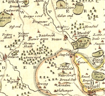
Detail from the 1753 or 1772 edition
~~~~~~~~~~~~~~~~~
In about 1693 Morden is believed to have produced a plate of a Hertfordshire map at 0.19 inches to the mile for inclusion in Camden's Britannia, but this was rejected because the scale was too small. It is based on Seller's map but some additions were made to the plate, suggested by Oliver's map, including the place table in the top left corner. It was published in 1701, initially without the compass indicator in the bottom right corner, in The new description and state of England, containing the mapps of the counties of England and Wales, in fifty three copper-plates, newly design'd, exactly drawn and engraved by the best artists ...
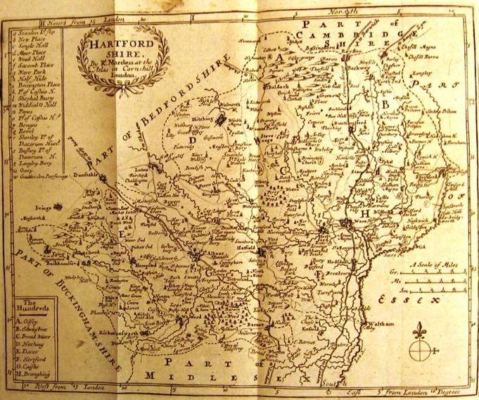
At the end of the 18th century pages of the Hertfordshire Section of the Magna Britannia were issued with this map and spurious title pages, by "the Rev. Thomas Cox". The above map comes from one of these volumes,
Robert Morden also published a playing card map in 1676
For more information see Printed Maps of Hertfordshire.
Page updated January 2008