click on picture for full screen image

Talks

Notes for a talk on

Brick Pits and other Old Holes on Bernard's Heath

by Chris Reynolds

Presented at the St Albans & District Local History Autumn Conference

on 22nd October at the Verulamium Museum

Back Slide 14 Next

Subsidence at Hastoe, near Tring

Deep wells on former brickworks have given problems elsewhere.

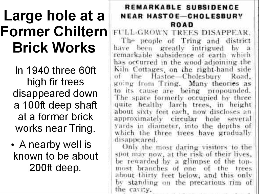
In 1940 three 60 foot high fir trees disappeared down a previously unrecorded vertical shaft near Tring. The long abandoned brickworks site is geologically very similar to the situation on Bernards Heath, but it is in a wood far from any significant settlement. It seemed the hole musy have been at least 100 feet deep which is not surprising as a well that was built to supply drinking water about a mile away was about 200 feet deep.


REMARKABLE SUBSIDENCE NEAR HASTOE-CHOLESBURY ROAD

 FULL-GROWN TREES DISAPPEAR

The people of Tring and district have been greatly intrigued by a remarkable subsidence of earth which has occurred in the wood adjoining the Kiln Cottages, on right-hand side of the Hastoe-Cholesbury Road, going from Tring. Many theories as to its cause are being propounded. The space formerly occupied by three quite healthy larch trees, in height about sixty feet each, now discloses an approximately circular hole several yards in diameter, into the depths of which the three trees have gradually disappeared.

Only the most daring visitors to the spot may now, at the risk of their lives, be rewarded by a glimpse of the topmost branches of one of the trees about thirty feet below, and this only by standing on the precarious rim of the cavity.

It is estimated that the total depth of the pit must be approaching 100 feet.

Searching for a clue to the mystery, older inhabitants have recalled that in the 1890’s a lime or chalk pit was being worked in this neighbourhood, and the presence of kiln of some kind is also suggested by the name given to the cottages and farm nearby. It is thought that when the chalk pit or kiln was abandoned it may have been filled in or timbered over, and that an underground stream, of which there are said to be many in the neighbourhood, has gradually undermined the sub-soil.

Some visitors have tested this latter theory by tossing stones into the pit, and they claim to have heard the faint splash of water.

It would certainly seem that only the presence of a very large cavity in the subsoil or of subterranean stream could account for the disappearance of so many tons of earth.

Bucks Herald, 1st March, 1940


The fanciful explanation give seems unnecessary as everything seems compatible with a large and deep well which had been boarded over and covered with earth. There is little doubt, from later 19th century records, that the area round the hole was used for making bricks - with many acres of clearly visible brick pits in a nearby wood. For more information of the brickfields around Tring, including a picture of some of the unfilled brick pits see Brick Pits & Brick Buildings near Tring

Information about another Subsidence in a Hertfordshire Brickfield area

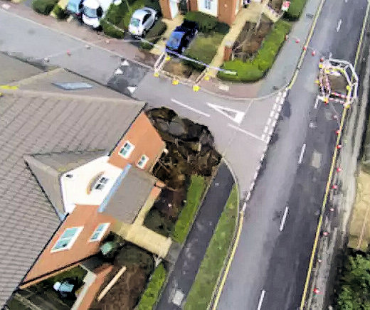
While this hole is exceptionally big for the UK there have been other local examples. A similar collapse under the corner of a house - but on a smaller scale occurred in 2014 in Oatridge Gardens, Hemel Hempstead.

Geologically the area is very similar to Bernards Heath - high ground covered with clay with flints overlying several hundred feet of chalk. There were a number of brick works in the area running north from Leverstock Green in late Victorian times and there are references to brickmaking in the Hemel Hempstead area as early as 1603 [see The Leverstock Green Brick Fields and the description of brickmaking on page 67 of The History of Hemel Hempstead.]

While I have no evidence that Oatridge Gardens is on the site of a filled in brick pit at least one Victorian O.S. map shows a "clay pit" near by it is not far from High Street Green where "Several places ... have been excavated mainly on land which belonged to the Saunders family, who were brickmakers in the 18th century." [History of Hemel Hempstead]. I have seen no authoritive report on the cause of the Oatridge Gardens collapse but at least one report suggests that subsidence as a result of human mining activities could be to blame.


This picture, and the events of September 2015 in Fontmell Close, make it clear why people are asking "What is under the ground on Bernards Heath, St Albans." I will be looking at why people dug holes in the area and what happened to them.


The Biographical note I provided to the Conference Organisers

After taking early retirement from Brunel University Chris Reynolds developed an interest in family and local history and now runs the Genealogy in Hertfordshire web site www.hertfordshire-genealogy.co.uk. His great grandfather, Jacob Reynolds, was a tenant of Heath Farm and as a result Chris has carried out extensive research on Bernards Heath, including publishing the booklet A Short History of Bernards Heath. He has also written a book about Hemel Hempstead during the First World War, The London Gunners come to Town.


Further Family Background information:

I was born in St Albans shortly before the war, while my father was poultry farming at Sandridge on part of Hammonds Farm - and family connections with the farm  go back to around 1800, if not earlier. However I was brought up in the West Country and returned to Hertfordshire in 1962. My great grandfather Jacob Reynolds took over Heath Farm (from Hammonds) in 1871 and in addition to being a major milk supplier in St Albans became involved with brick making, as some of the brick pits were on his former fields. A member of the family was living in either Heath Farm (until it was demolished) or in a home built on the Home meadow into the 21st century. My grandfather, Harry Reynolds, built Calverton (the house at the start of Harpenden Road, looking down St Peters Street) and was a vet who worked with horses. For a time he also was a job master, which included running the St Albans waste collection service, and his men were tipping the rubbish into disused brick pits on Heath Farm in the early 20th century. For a time Beryl Grove (Jacob's grand-daughter) lived in a flat in Heath Farm and did some preliminary research on the farm prior to its demolition. I talked to her about working together to write a history of Heath Farm. After her death I collected a lot of information about the Farm and the surrounding area, including identifying many of the brickmakers. Some of the findings have been posted on this web site.


While this hole is exceptionally big for the UK there have been other local examples. A similar collapse under the corner of a house - but on a smaller scale occurred in 2014 in Oatridge Gardens, Hemel Hempstead.

Geologically the area is very similar to Bernards Heath - high ground covered with clay with flints overlying several hundred feet of chalk. There were a number of brick works in the area running north from Leverstock Green in late Victorian times and there are references to brickmaking in the Hemel Hempstead area as early as 1603 [see The Leverstock Green Brick Fields and the description of brickmaking on page 67 of The History of Hemel Hempstead.]

While I have no evidence that Oatridge Gardens is on the site of a filled in brick pit at least one Victorian O.S. map shows a "clay pit" near by it is not far from High Street Green where "Several places ... have been excavated mainly on land which belonged to the Saunders family, who were brickmakers in the 18th century." [History of Hemel Hempstead]. I have seen no authoritive report on the cause of the Oatridge Gardens collapse but at least one report suggests that subsidence as a result of human mining activities could be to blame.


Octoober 2106   Page Created