|
|
Grand Union Canal Bridge 116, Watford February, 2012 |
|
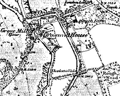
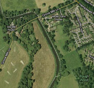
The maps on the right show the area as it was in about 1880 (courtesy of www.old-maps.co.uk) and as it is now (courtesy Google Maps). The name is actually Rough Wood Bridge and is named after the adjacent wood. The bridge was clearly there over 130 years ago. The map also shows Grove Mill Lane and Heath Farm. The bridge may well have been there from the early days of the canal as it is a key functional bridge carrying the towpath from one side of the canal to the other. The narrowing of the canal at this point and the fact that the bridge is on the slant are all relevant to this function. In general cross-over points were minimised as horses had to be unhitched in such situation and reattached on the other side. There is only a short length of tow path on the east bank of the canal and this could be due to the occupants of The Grove refusing permission on their side of the canal. I have not seen any pictures of the bridge, and haven't walked this part of the canal myself, so cannot comment the age of the current bridge and its footings. |
 |
|
|
|

