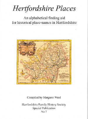
 Hertfordshire
Places
An Alphabetical finding aid for historical place-names in Hertfordshire
Compiled by Margaret Ward
Hertfordshire
Family History Society
Special Publication No 7
2008
INTRODUCTION
Finding places mentioned in old documents or census returns is not always easy. Names change or are spelled differently at different times, what was a 'farm' may have become a 'hall' or vice versa, or a place may simply have ceased to exist.
This book contains the names of over 3,000 parishes, hamlets, farms, halls, woods and commons within the county, and although it would be presumptuous to suggest that it is an exhaustive list of every Hertfordshire place-name to be found over the last two or three centuries (ie including the late 18th, 19th and 20th centuries) it is intended as a useful initial finding aid for the family historian.
This is a very useful document for identifying place names - and includes names from the Victoria County History for Hertfordshire, The Place-names of Hertfordshire, the Ordnance Survey Gazetteer and some other sources. There are expanded entries for the ancient parishes and short entries for the parishes created in the 19th and early 20th centuries.
| Locating
Books This book is available from the Hertfordshire Family History Society |
It is perhaps worth adding a general comment on the scope of this book. Its main sources are the Victoria County History and The Place-names of Hertfordshire which are both concerned with information obtained from property related records.
The Victoria County History contains a lot of information relating to the church and manorial estates. Where an estate consists of many farms the individual farms are usually not named unless they are of particular historical interest.
The Place-names of Hertfordshire is organised parish by parish and is very much concerned with the derivation of the place name, and any mention in medieval records. Hertfordshire is full of Ends and Bottoms - but descriptive names such as Church End, Hill End or Boggy Bottom are only mentioned if there is a medieval record. In addition places which appear to be named after a former owner - but for which no medieval records were found are also omitted.
Another source of names (not used in the book) was concerned with recording what is there, irrespective of whether there were any historical records or not. In recent years the Hertfordshire Record Society have republished Dury & Andrew's Map of Hertfordshire 1766 and Bryant's Map of Hertfordshire 1822 - in each case including a detailed index of places shown on the map.
I decided to look at the places in Sandridge marked on Bryant's map to see which were in the book (green) or not included (fushia):
Sandridge, Bernards Heath, Sandridge Lodge [Marshalswick], Wheelers, Evans Farm, Nash's Farm, Caps Farm [sometimes Copses Farm], Woodcock Hill, Fearfulls [Fairfolds Farm], Hammings Farm [Hammonds Farm], Broxhill, Tower Hill Farm, Colemans Green, Samuels Farm [Samwells Farm], Chalkdell Farm, Lower Beech Hyde, Upper Beech Hyde, No Mans Land Farm, Hill End Farm, Pound Farm, Sandridge Bury, Cheapside Farm, Greens Farm.
Most of the "missing" places names are farms which seem to be named after former farmers. although Chalkdell Farm and Fairfolds Farm would appear to be descriptive. I believe that all these farms were copyhold properties in the manor of Sandridge. Sandridge Lodge was a short-lived renaming of Marshalswick.
The real problem is that any list is bound to be incomplete. For instance Bryant's map doesn't give field names, street names in towns, or the names associated with yards leading off town streets. For most purposes the book is a very useful too which will answer 99% of questions, but for the remaining 1%, involving individual farms or common descriptive names care must be taken.
Page created February 2009
