|
The Maps
of [Up to about 1900] |
|
The Maps
of [Up to about 1900] |
|
Please Note The Map pages on this web site are in the process of being rearranged. This will be the new Map "home page" with associated menus. For the time being the old "Introduction" page will be retained - as many pages still link to it. In addition a number of individual pages are being reorganised while new pages are being added as time allows. In some cases empty pages are being used as place holders and content will be added as soon as possible. Chris, November 2008 |
When you are researching your family tree it is essential to have a good understanding of the local geography, and fortunately there are a wide range of maps which you can use.
Printed Maps
County Maps - The earliest printed maps were produced on a county by county basis, with little or no information on adjacent counties. The first of these was by Saxton in 1577. They continued to be popular until Victorian Times. The most detailed county map produced before the coming of the canal and railways was by Dury and Andrews, in 1766, and which shows individual farms. You may select a menu of county maps illustrated on this web site by date or by map maker.
Strip Maps - As travel became easier the need for travellers guides became more important and John Ogilby was a pioneer whose road atlas was published in 1675. Such maps not only show the road but also identify feature alongside it.
Ordnance Survey - The Army started producing 1 inch maps of the country in about 1800 and over the years many different maps, at different scales, have been produced. Certain of the maps series, from the 19th century to the present day, are readily available in printed form or online. In particular Old-maps allows online access to large scale ordnance survey maps, which, in Hertfordshire, were surveyed in about 1881.
Town Maps - To be Supplied
Specialist Maps - Geology, Political, Unions, etc - tp be supplied
Manuscript Maps
Inclosure Maps - To be Supplied
Tithe Maps - To be Supplied
Estate, etc., Maps - To be Supplied
Gazetteers - These are geographical indexes, often with descriptions of places and maps. One available on CD is Cassell's Gazetteer of Great Britain and Ireland, from the 1890s, while an earlier one is the Topographical Dictionary of England, published in 1831. The Little Guide for Hertfordshire (1903) (on CD) includes a gazetteer, a useful railway map, and a county map where you can zoom in for detail.
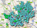
Genealogical Maps - Several maps exist to help people doing genealogical research. GENUKI has a simple map showing the historic parishes.
Area Maps
Specialist maps
Manuscript Maps
|
The following comes from the old Introduction Page and is awaiting reorganisation. There are also some dummy pages awaiting text.
Genealogical Maps: Maps have been specially provided to help the genealogist. Manuscript Maps: Not all maps are printed, and estate and tithe maps can contain very valuable information - sometimes down to the identification of the occupier/owner of an individual property. See Calalogue of Manuscript Maps
Click here for Map Index |
Page created March 2008