|
Maps of Hertfordshire |
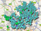
This is an index of the maps, or sections of maps, illustrated on this site and will be updated as new maps are added.
| GENUKI has a simple map showing the historic parishes. |
1577 Saxton The earliest map of Hertfordshire, with link to a reasonable sized image.
1593 Nordon - Large image of map (1903 reprint) available online.
1646 Jansson A combined map of Middlesex and Hertfordshire, with West at the top.
1673 Blome An early map used to illustrate the hundreds on this web site
1675 Ogilby. An early road map
1676 Morden. Map on a playing card.
1676 Seller A county map produced by John Sellers and possibly surveyed by John Oliver.
1695 Oliver While this map was by John Oliver it shows different detail to the Seller's map.
1695 Morden This map was reprinted (with very minor changes) in various editions of Camden's Britannia until 1772.
1719 Ogilby. London to Kings Lynn - Section from Puckeridge to Barley
1724 Moll. From A New Description of England and Wales ...
1746 Simpson A map from the English Traveller, which included extensive information on each county. - with high-resolution image available.
1755 Britannia Depicta A road atlas by John Owen & Emanuel Bowen.
1763 Bowen A map used to illustrate the hundreds on this web site
1766 Dury. An early large scale map of the county.
1787 Cary. Cary published a series of Hertfordshire county maps, and other maps related to the county up until 1843,
1791 Haywood. A medium sized map of the county.
1800 Cary's Actual Survey of the Country Fifteen Miles Round London
1801 Cary's Survey of the High Roads from London. A later road map at the time turnpike roads were becoming important.
1807 Cooke. A small map, printed with west at the top, published in an early travellers guide.
1808 Smith. A large scale map published in atlas and sheet form.
1808 Cooper. A small scale map showing the hundreds and larger towns and villages
1820 Neele. A small map in The History and Topology of Hertfordshire
1822 Bryant. A large scale map at 1.5 inches to the mile - the last private survey of Hertfordshire.
1833 Archer. A map in "negative" style from The Guide to Knowledge.
1835 Cary's New Map of England and Wales. - Covers Middlesex and Hertfordshire
1837 Moule. An attractive looking 19th century county map
1842 Archer. A map from Dugdale's Curiosities of Great Britain, England & Wales delineated.
1844 Crighton. A Map from Lewis's Atlas to the Topographical Dictionaries of England and Wales, showing the Poor Law Unions.
1864 Dean. Surface Geological map
1903 Railways - from Hertfordshire - Little Guide
1904 Bacon - Turn of century atlas map, based on Ordnance Survey.
Last updated January 2008