|
Totteridge
This was
a detached chapel of Hatfield parish, and was almost completely
surrounded by Middlesex but with a boundary with East Barnet. In
1892 it became a separate parish and since 1965 it has been part of the Borough of Barnet, Greater London |
|
|
It is in
Broadwater Hundred
and Barnet
Union
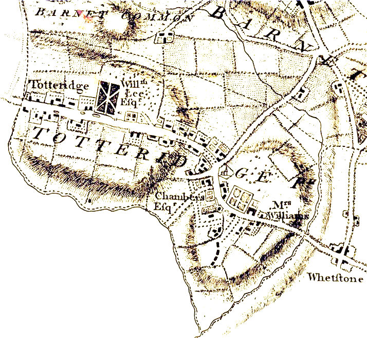
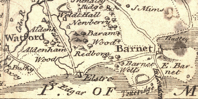
From Dury
& Andrews 1766 map of Hertfordshire
Totteridge, on the Middlesex border, is 1 mile
west from the Station (G.N.R). Richard Baxter lived here for a short time. The
neighbourhood is well wooded and very pleasing to the eye. The church, on the
hill-top, dates only from 1790; but the site was occupied by an earlier
structure. The memorials are of no historic interest; but near the enormous yew
tree in the churchyard stands the tomb of the first Lord Cottenham (d 1851).
Near by, too, lies Sir Lucas Pepys, physician to George III (d 1830).
Totteridge Park, west from the village, was
the residence of Baron Bunsen, and of the above-mentioned Lord Cottenham; the
large plain structure in which they lived, recently in part rebuilt, was erected
about a century ago, taking the place of the fine old manor house, for some
generations the home of the Lee family.
At Copped Hall, near the church, the late
Cardinal Manning was born in 1808.
Hertfordshire
Little Guide 1903
 |
|
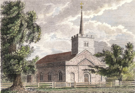
Totteridge, Herts
Published Feb 24th, 1809, by S. Woodburn, No
112, St Martin's Lane, London.
This was published in Volume 2 of
Ecclesiastical Topography - A Collection of 100 Views of
Churches in the environs of London, edited by Samuel
Woodburn and published by William Miller in 1811. |
 |
 |
|
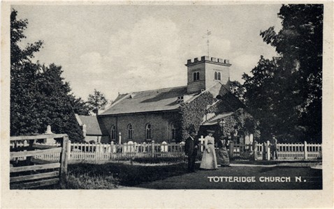
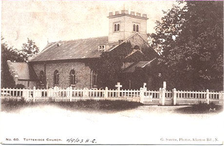
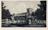
Totteridge Parish Church
�
Published by G. Smith, Allerton Road, N. Undivided back posted
in 1903
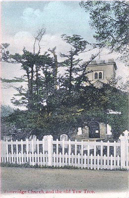
Totteridge Church and the Old Yew Tree
�
Postcard published by Gordon Smith, 15 Stroud Green Road, N.
and posted in 1908
|
Book: A Short History of Totteridge
- includes parish registers to 1837
Census: 1861: Parts of area included in Middlesex It includes
Totteridge Park School - with a long list of boarding pupils.
|
In the Hundred of Broadwater
is
'Totteridge',
a very pleafant Village, on a fine Eminence, looking to
the North over St Alban's Road, into the Fore11:, and on the South over the Edgeware Road to
Harrow.
'Tis a very clean Place, has feveral very good Houfes, and is well known to the Citizens of
London, who frequently take a Ride hither for the Air. It has its Name from its Situation on the Ridge of a Hill. 'Tis reckoned an Hamlet to Hatfield, and its Tithes are paid to the Rector of Hatfield, who is
obliged to find a Curate to serve its Chapel; yet fince Queen
Elizabetb,
it has been reputed a diftinct Parish; for the Inhabitants choofe their own Conftables, Church. Wardens, and Overfeers of the Poor, and pay neither to the Church nor Poor
at
Hatfield.
Here is an handfome Houfe of the late Lord
Bateman, and another of Mr.
Decofta,
a wealthy Jew.
The Agreeable Historian,
1746 |
|
|
|
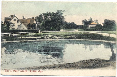
More cards by Gordon
Smith, 15 Stroud Green Road, N
The Lower Green, Totteridge
Not numbered, posted 1908
~~~~
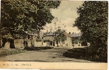
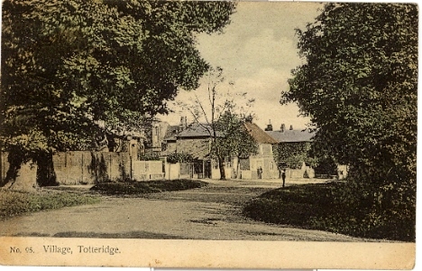
The Village, No 95, posted 1908 |
ON THE WEB
There is a very useful document -
Totteridge Conservation Area: Character Appraisal Statement - at
http://www.barnet.gov.uk/totteridge.pdf which provides detailed maps of
the old parts of Totteridge and some background history. It is a planning
document produced by the Barnet Council.
Quick links to
extra postcard images.
click on thumbnail picture |
Totteridge Church |
The Village |
|
| |
|
|
| August 2010 |
|
1809 Print of the church |
| August 2010 |
|
Description from 1746 |