Akeman Street & The West End
Akeman Street & The West End
|
|
 |
|
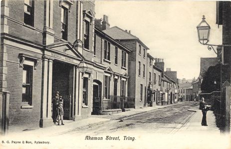
| Akeman Street, Tring - by S. G. Payne - circa 1903 | ||
Akeman Street runs from the town centre crossroads South past the Museum and on towards Hastoe and Cholesbury (Bucks). Much of the frontage at this end of the street remains - although some of the commercial properties and their yards have been converted to housing or more modern industrial use.
The building on the left, carrying the words "Victoria Works". It was build in 1886 as a large hall, with a first floor ballroom and designed by the local architect, William Huckvale. In 1899 a show was put on by the Walford Family - including "animated Pictures" with the "Cinematograph" (See Posters of 1899). In May 1901 it was sold to become a factory, hence the words "Victoria Works" over the door. This did not last long and it was back in use as a public hall in 1906.
|
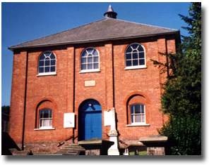
Further up Akeman Street, on the right, there is the Akeman Street Baptist Church - whose history is described in the book The Akeman Street Story.
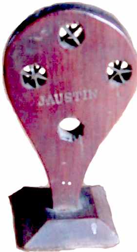 |
In Victorian times the street had links with straw plait industry. Straw plait was made using split straws and James Austin, a wood turner who lived in Akeman Street, approximately opposite the Baptist church made a straw splitter which was widely used. (See Splitting Straws.)
There were many yards leading off the road and in 1848 Lucy Marshall was born in Harrow Yard. She was the Lucy Luck, straw plait worker, whose biography is published in the book Useful Toil. The biography only identified people by initials but these have now been identified - see Lucy Luck, straw-plait worker.
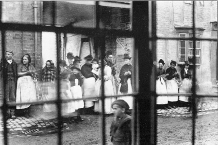 |
Women plaiting straw in Akeman Street (From Dacorum within living memory. The same picture occurs in Tring: A Pictorial History) The picture was taken in 1896 and the women, who lived in Harrow Yard, had come into the street to watch a funeral pass by. The bay window on the right of the picture is part of the Harrow, and the picture is taken through the bay window belonging to Thomas Grace on the other side of the road. |
|
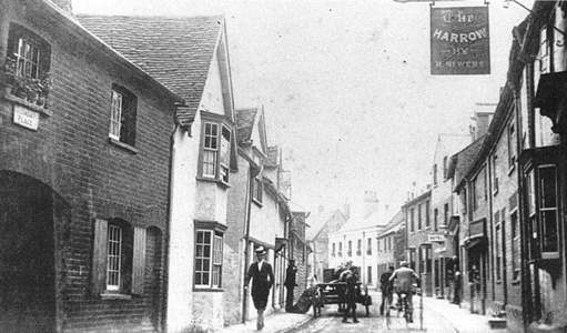
This picture, which shows the sign on The Harrow, comes from the book Tring in old picture postcards: Volume 2. On the left is the entrance to another of the yards, Clement Place, and the white building is Thomas Grace's yard. He was a maltster, corn and seed dealer. There is a chapter on Tring brewers and maltsters in the book Brewers in Hertfordshire. |
 |
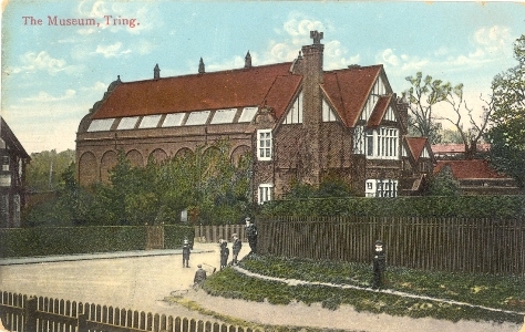 |
At the top of Akeman Street there is the museum built by Walter Rothschild.
� Postcard circa 1904, no publisher. |
The road in the foreground runs alongside Tring Park and leads to Cholesbury and Chesham, Bucks, with a turning at Evan's Spring which leads to Hastoe. The hedge alongside the road hides the Quaker burial ground, where there is a single simple memorial stone. Akeman Street runs alongside the museum, and the group of boys are standing in Park Road.
Park Road
|
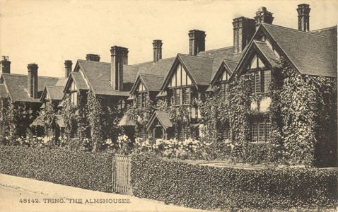
The Almshouses Tring Louisa Cottages front onto Park Road and were build by the Rothschilds. The corner of the first cottage can just be seen in the previous picture. In the 1901 census the occupants were Sarah Nutkins (74, widow of estate labourer), unoccupied, John Horn (77, retired estate labourer), Elizabeth Cross (69, widow of estate labourer) and Thomas Richardson (70, late estate labour). |
 |
|
|
|
|
|
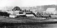
A view of Tring showing Prospect House School (demolished circa 1901) with Louisa Cottages and the museum to the right. |
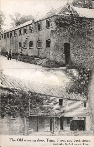
Now that Prospect House has been demolished all the houses along Park Road are on the north side, overlooking the fields of the Home Farm (and now towards the well hidden bypass). Starting from Louisa Cottages you pass a terrace of Victorian houses and at the junction with Langdon Street there is the Castle Inn where Robert G Ives was landlord (1901 census). There follows a variety of houses and terrace cottages until one reaches the the drive to the Home Farm. Beyond this there was a large house called The Furlong on the north side with Cato's canvas weaving workshop (now demolished) on the south side.
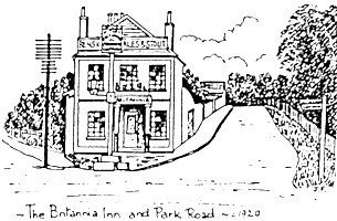
Park Road continues until it meets with Western Road. The Britania Inn (now a private house), landlord Mary Ann Harris (1901 census) stands at the junction, the combined roads continuing up the hill towards Aylesbury.
 The West End
or Tring Triangle
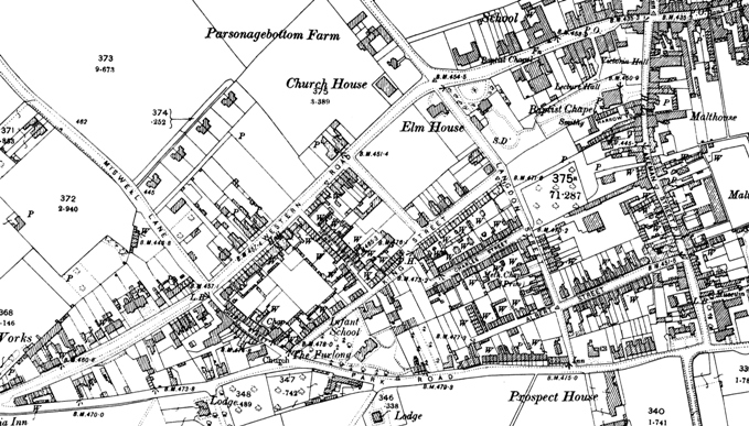
As can be seen by the above Ordnance Survey Map of 1897 Akeman Street, Park Road and Western Road form a triangle. During the Victorian period this area was developed, mainly redeveloped with rows of working class terraced cottages, many of which were 2 rooms up, 2 down, with a dunny and coal shed in the garden. The area containing Albert Street, Langdon Street, Charles Street, King Street, Henry Street and Chapel Street was known as the West End of Tring. Postcards of this area are note very common.
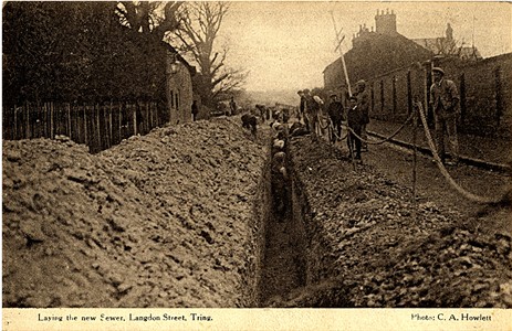 |
Laying the new sewer |
There is an excellent booklet, The Tring Triangle, which includes line drawings (such as the one of the Britannia Inn above)
Page updated December 2008