|
The Road Through Harpenden |
|
The Road Through Harpenden |
Saxton's Map of Hertfordshire
1577
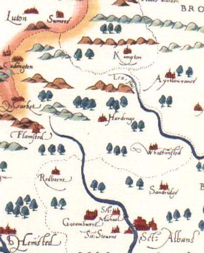
From modern reproduction by Taylowe Limited
During the 16th century John Leland passed along the road between St Albans and Luton, when it passed through "woody and enclosyd ground." In addition Saxton published the first county map of Hertfordshire - which however did not show the roads. The first Hertfordshire map to show roads was produced by John Norden in 1598
See Lucy Toulmin Smith (ed), The Itinerary of John Leland in or about the years 1535-1543, Vol I, pp 104-5, Vol IV, p 34, quoted in L M Munby, The Hertfordshire Landscape
For information on old maps of the county see The Printed Maps of Hertfordshire, 1577-1900
<<< Back <<< Index >>> Next >>>
If you can add to the information given above please tell me.