|
The Road Through Harpenden |
|
The Road Through Harpenden |
Rothamsted Estate Map
1623
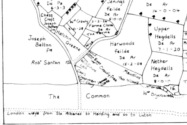
Redrawn from "Plot of the Demeanes of the Mannor of
Rothamsted" 1623 in Wheathampstead and Harpenden Volume II.
This is part of the earliest detailed map
to show part of the
"London waye from Ste Albanes to Harding and so to Luton"
At the time this map was drawn virtually all the traffic along the road would be "on foot". A pack-horse could carry between 2 and 3 cwt, a wagon, needing several horses was limited after 1662 to a load of 30 cwt in summer by law: this was raised in 1741 to 3 tons, and in 1765 to 6 tons.
Cattle and sheep would be driven to market, keeping them in good condition as they could rest and graze on the way. The half million sheep and 75,000 cattle that were sold at Smithfield in 1700 all came overland. In East Anglia, Defoe marvelled at the droves of turkeys walking to the capital, often, he was told, between 300 and 1,000 at a time.
<<< Back <<< Index >>> Next >>>
For more about part of this area see West Common, Harpenden
If you can add to the information given above please tell me.
Page updated March 2005