CAMP, Railway Terrace, Hertford St John, 1866-1871
July, 2004

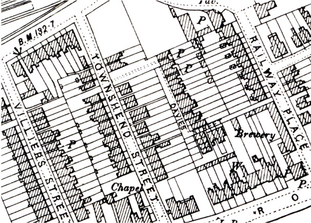
The first thing to do is to locate where Railway Terrace was. The 1881 census lists about 20 households living there, and it was somewhere south of the railway line between Railway Street and Ware Road, in the area of Railway Place, Townshend Street and Villiers Street. To find the Terrace I used the the approach described in Locating Census Addresses from Maps and the 1897 large scale Ordnance Survey map of Hertford (above, from the Alan Godfrey reprint). The map shows a narrow alley called Davies Street, entered from Railway Place, containing about 20 terrace houses. Davies Street is not named in the census and it is clear that these houses must be the ones called Railway Terrace.
I don't know this part of Hertford but a look at a modern online map such as Multimap shows that the current road layout is unchanged, and I would suspect that the original houses are still there.
Perhaps someone who knows the area could tell me that the Terrace is still there - and perhaps even provide a photograph which could be added to this page.
There is a web page for Hertford
If you can add to the information given above tell me.